 |
| Inside Redlands is posted monthly by the Office of Public Relations. Submissions can be sent to Monique Henderson. Deadlines for submissions are the second Monday of each month. Call (909) 335-5228 for more information. |
|
|
Calendar All Shook Up The university's academic calendar will change for the first time in more than 30 years in 2002-03, with the interim term moving from January to May. In announcing the change, President James Appleton acknowledged the benefit of the month-long term while adding that a change in its place in the calendar would improve its academic focus. Initially met with some gasps, the president's decision now has "freed up our thinking," said College of Arts and Sciences Dean Nancy Carrick. "When you do something for more than 30 years, your planning can become routine," she said. "The president shook us up. We had to ask ourselves, 'What is it that students really need?'" One thing that emerged from subsequent faculty conversations was the importance of the month-long learning experience. "It's one of the special things about this university," Carrick said. "When students are in a class three hours a day every day, the subject enters their psyche in a very different way. The month opens up incredibly creative opportunities for learning with travel programs, side trips, internships and research projects." Since the change was announced, faculty have brought forth proposals for new ways to use the month-long term. Some departments are redesigning senior seminars with more emphasis on the transition from college to graduate school or the workplace. New travel courses have been proposed that would not have been possible during the winter. The School of Music is particularly pleased by the change, as there will be less interruption in practice schedules. In other ways, the new May term will mirror Interim, with many of the same courses and opportunities to complete the community service learning requirement. Commencement will remain at the end of the month, assuring that May term will be an integral part of the calendar. Service to His Country
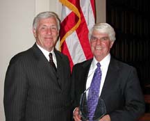
Congressman Jerry Lewis received the President's Award for Public Service in recognition of extraordinary service to his country following his lecture at the university Monday, Feb. 18. Joining the congressman and President Appleton at an earlier dinner were community leaders such as Al Karnig, president of California State University, San Bernardino; Donald Pursley, executive vice president of Loma Linda University; members of the board of trustees; and a number of community business and civic officers. Open House
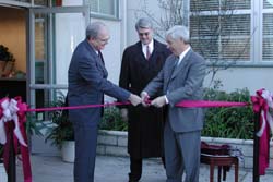
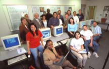
The remodeling of the new headquarters for the School of Education was celebrated during a ribbon cutting ceremony and open house held January 30 in University Hall North. The event marked the official end of a five-month renovation project. That allows all of the School of Education's faculty and staff to be centrally housed in one area. Before the move, representatives of the department were located at three different campus locations. The new working arrangement is expected to make it easier for people to communicate and to work together on a variety of projects. Before the renovation, space in University Hall was rented to a program that served people learning English as a second language. At one time, the building also served as a student union. The renovated building has been expanded to include four additional classrooms, as well as a high-tech computer lab. Education students use the new lab for a variety of tasks, including participation in online Blackboard discussions, research and word processing. If you missed the open house, it is still not too late to get a closer look at the School of Education's new headquarters. Feel free to stop in and see it for yourself! |
Campus News Out & About Employee News Suggestion Box Memos & Announcements Press Releases Calendars Archives Contact Us |


